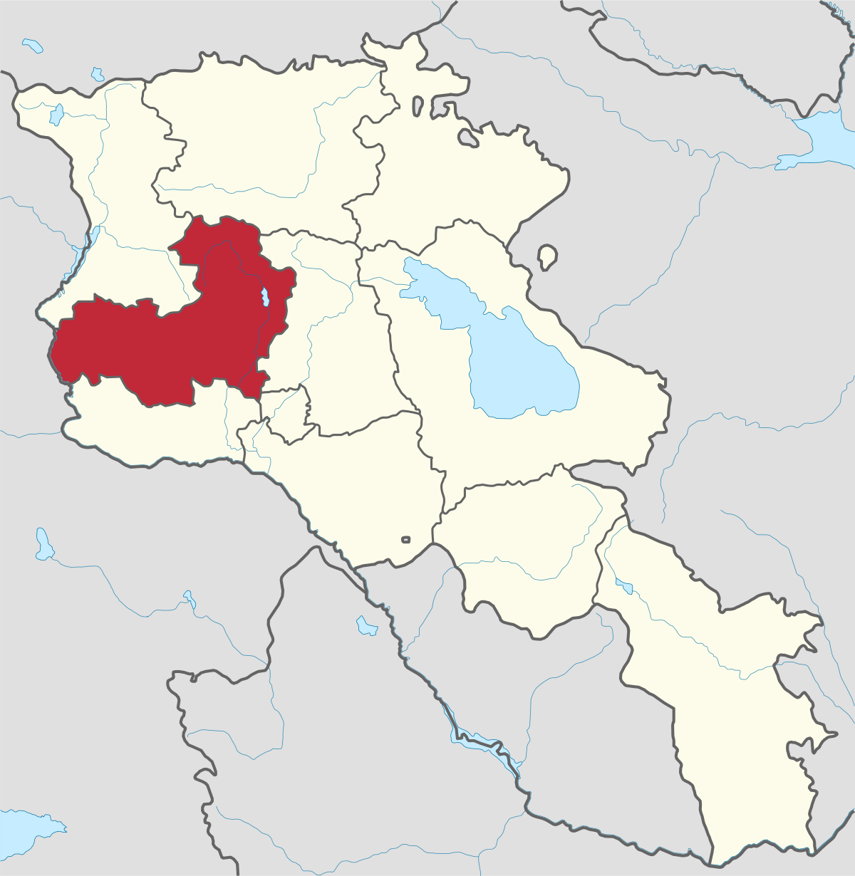
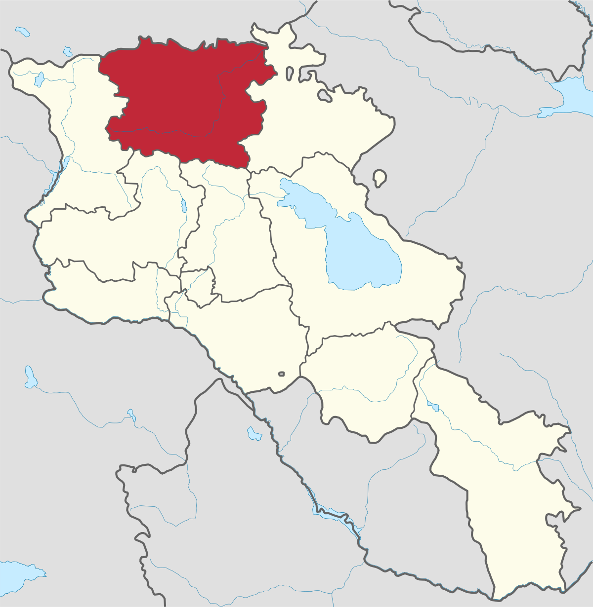
Aragatsotn Region
Aragatsotn is named after the massive mountain (4095m / 13,435 ft.) that hovers over the northern reaches of Armenia. This region is one of the...
Gyumri City
Territory: 36km2
Population: 150’000
Distance from capital/Yerevan: 126 km
Height of above sea level: 1550 m
The main branches of economy: industry, agriculture
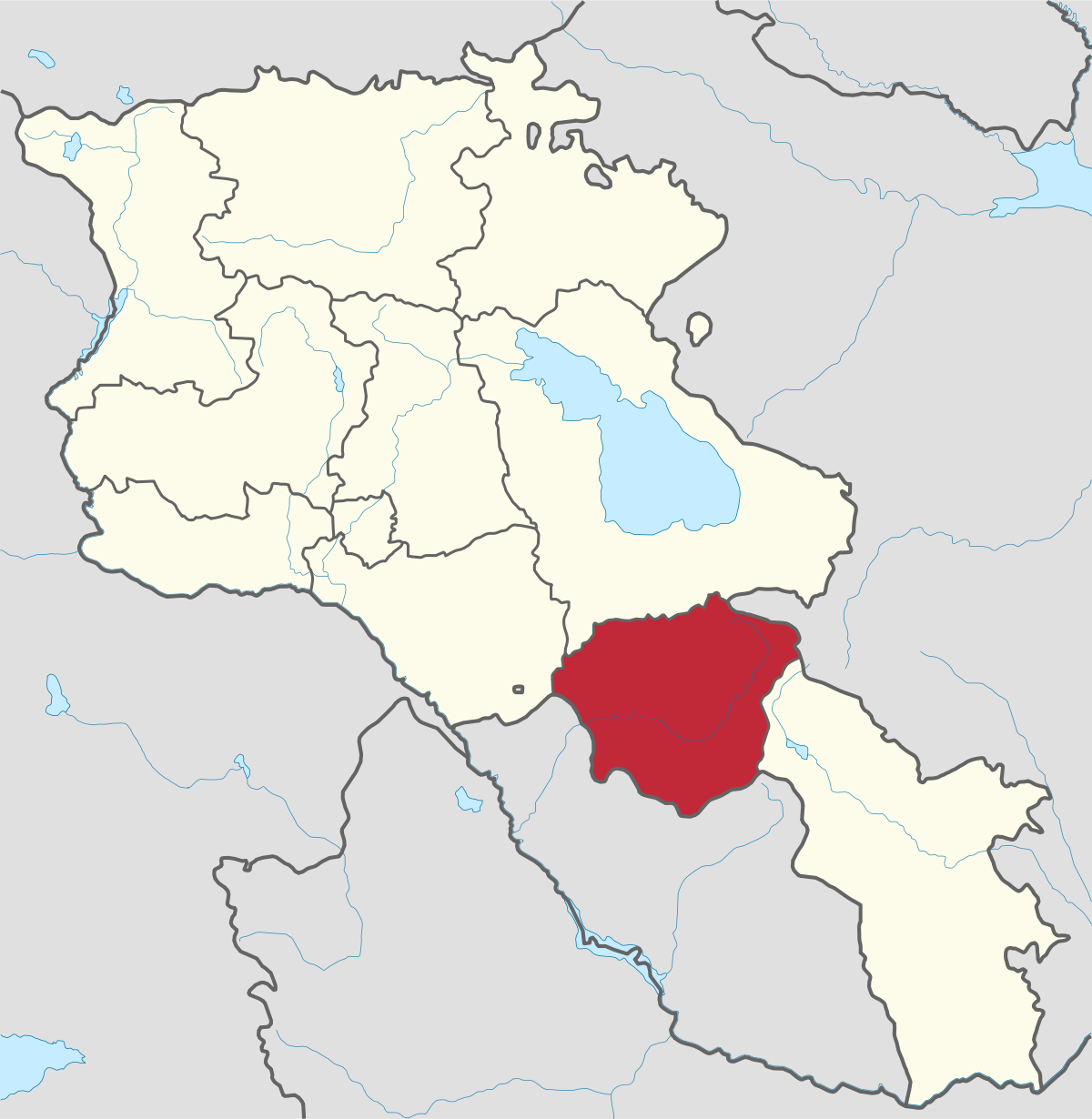
Gyumri is the second largest city in Armenia and the capital of the Shirak Province. It has always been famous with its unique cultural and social coloring which has influenced city’s architectural specificities as well.
Location
The city is situated 126 km from Yerevan (capital of the Republic of Armenia), in the northwestern part of Armenia, in the Shirak Valley, on the left bank of the Akhuryan river, surrounded with the Pambak Mountains from the east and Aragats volcanic range from the south. The climate is very dry.
History
Gyumri and the surrounding area have been populated since the ancient times. Settlements that have recently been discovered that date back to the beginning of the 3rd millennium B.C.E (the meat factory, Botanical garden, the Alexandrapol fortress, Black Fort, Vardbagh). The oldest mention of a state in the area of Gyumri was in the 8th century B.C. in an Urartian inscription and was called “Kumayri”. In 1837 the city was renamed Alexandropol after of Tsar Nicholas I's wife, Princess Alexandra Fyodorovna.In the Sovietn period the city was known as Leninakan in honor of Vladimir Lenin. After independence, the original name Kumayri was used until 1992, when Gyumri was chosen as the name of the city.
Economy
Gyumri had more than 500 craftsmen and was once recognized as a prominent center of trade and crafts. In the Soviet period it was a major transportation hub and big industrial center, especially mechanical engineering and metal processing was well developed.
Today the number of the factories is reduced. The earthquake had a disastrous impact on the city, as many buildings are still not recovered.
Tourist Attraction
On the main Square of Gyumi you will find 2 churches.
Saint All Savior Church – The church was built in 1873. The construction of this church was inspired by the gothic cathedral of Ani. During the Soviet period it used to serve as a philharmonic hall. In 1988 the church was ruined during the earthquake. Presently it is in renovation.
St. Seven Wounds Church –Built in 1874-1886, the church was initially named Holy Mother Church but it’s more known as the Church of 7 Wounds. The name refers to the Holy Mother’s icon with seven wounds found in the martyrium.
Almost all the churches were closed during the Soviet Union period but this church continued to operate. The church has 5 altars which served for people of various declarations of faith.

Aragatsotn is named after the massive mountain (4095m / 13,435 ft.) that hovers over the northern reaches of Armenia. This region is one of the...
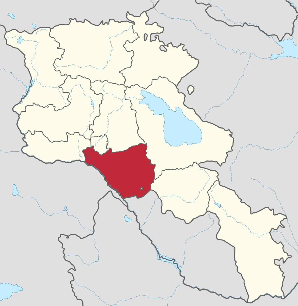
Ararat region is named after the biblical Mount Ararat which is mentioned in the Bible as a place where Noah’s ark has landed after the Great...
.png)
Armavir Region - Because of its Christian history the region is most famous for locals and Diaspora Armenians, who make pilgrimages to Armenia to...
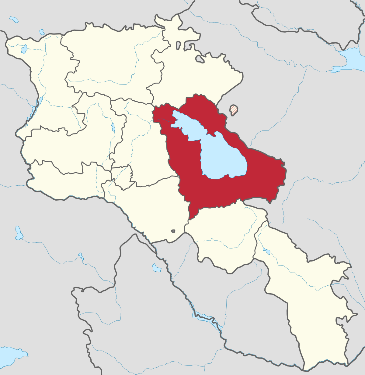
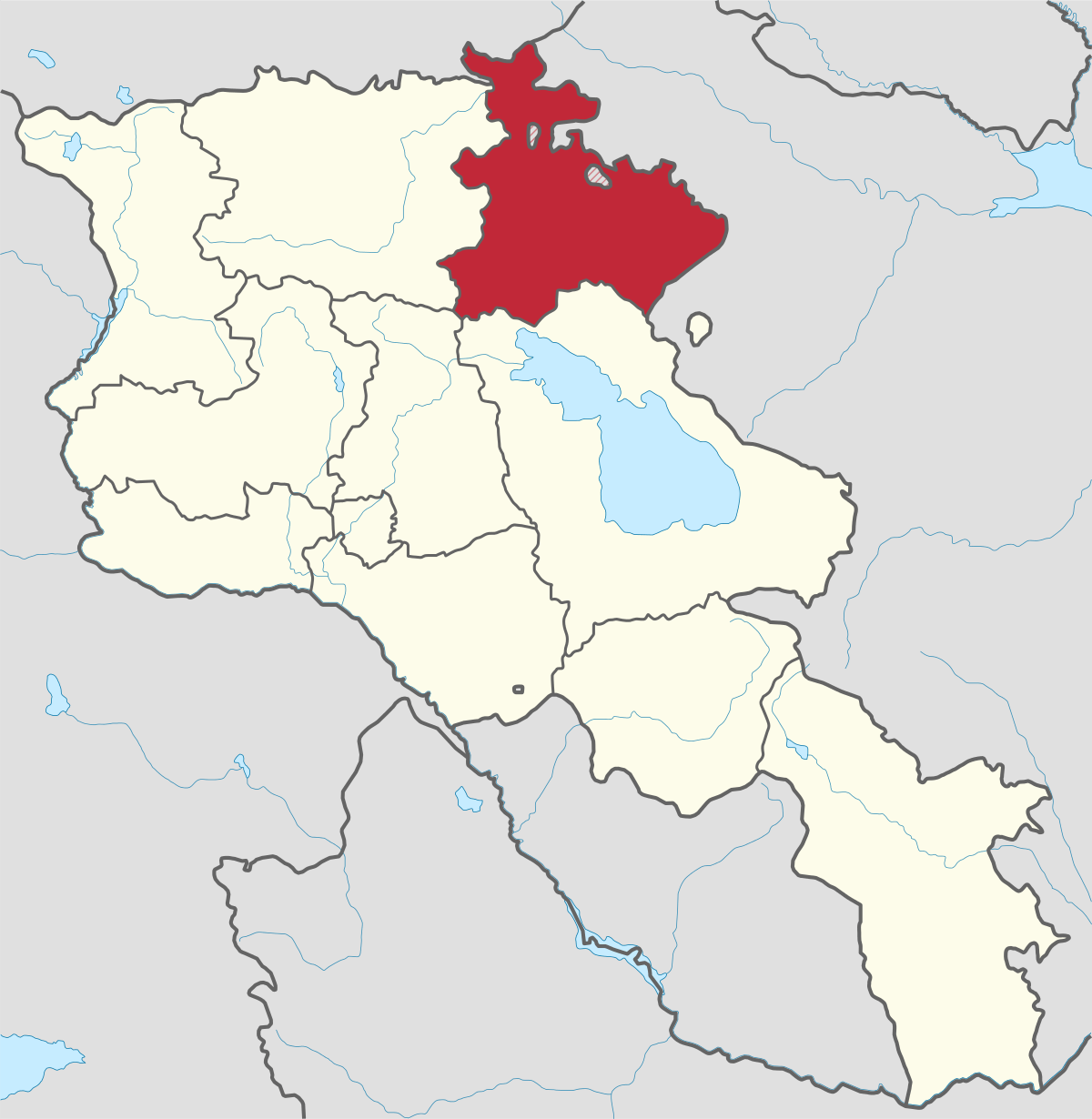
Gegharkunik ist die größte Region Armeniens, die an Aserbaidschan und die Shahumyan-Region der Republik Berg-Karabach grenzt. Ein Viertel der...
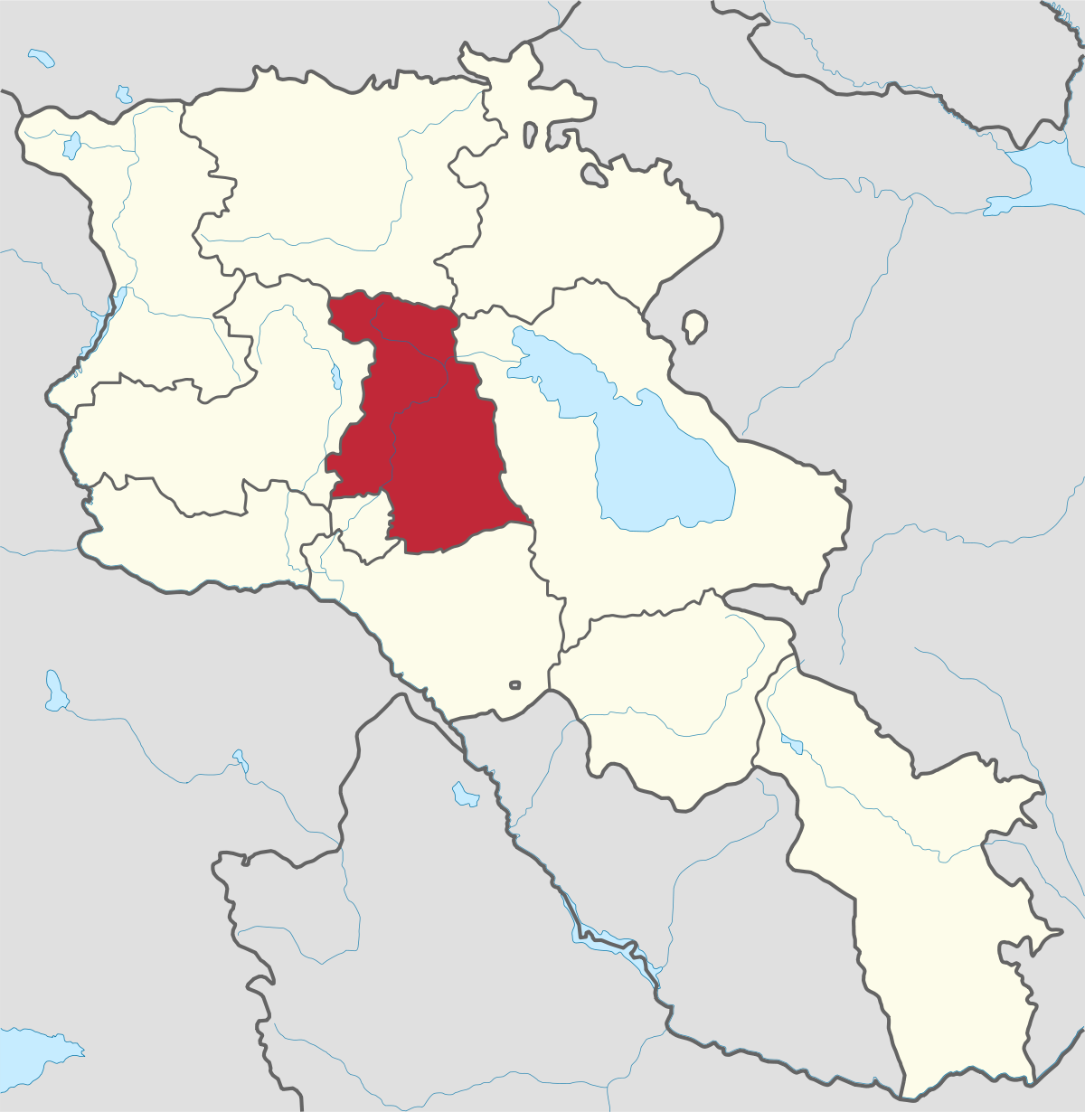
Kotayk region is located at the central part of the country and is home to many must-see sites in Armenia including the pagan Temple of Garni...
Lori region is in the northern part of Armenia, bordering on Georgia. It is considered Armenia’s greenest area, with more native forest land than...
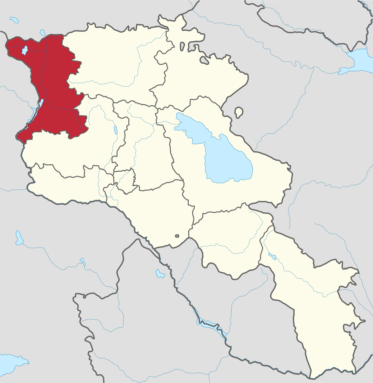
Shirak region lies in the north-west of Armenia. It borders with Georgia and Turkey. Shirak region is mainly dominated by the Ashotsk Plateau and...
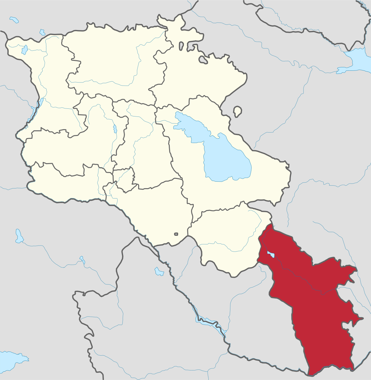
Syunik region- It is in the southern part of Armenia, bordering by Azerbaijan's Nakhchivan Autonomous Republic exclave, the de facto independent...
Tavush region lies in the Northeast of Armenia, bordering by Georgia and Azerbaijan. The territory is mainly mountainous and rocky hillsides...
Vayots Dzor region is mainly a mountainous region at the southeastern end of the country, known with Jermuk Waterfall, Areni cave, Smbataberd...
Yerevan city – 2800 years old. Yerevan is the capital of the Republic of Armenia with more than 1 million people. It is an amazing city with view...
800
149
1476
32