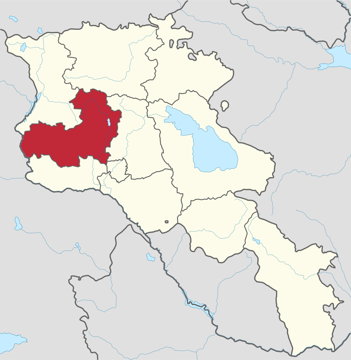
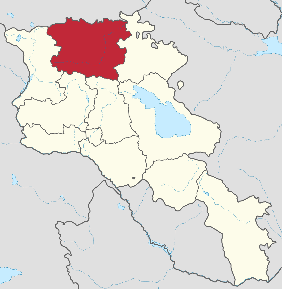
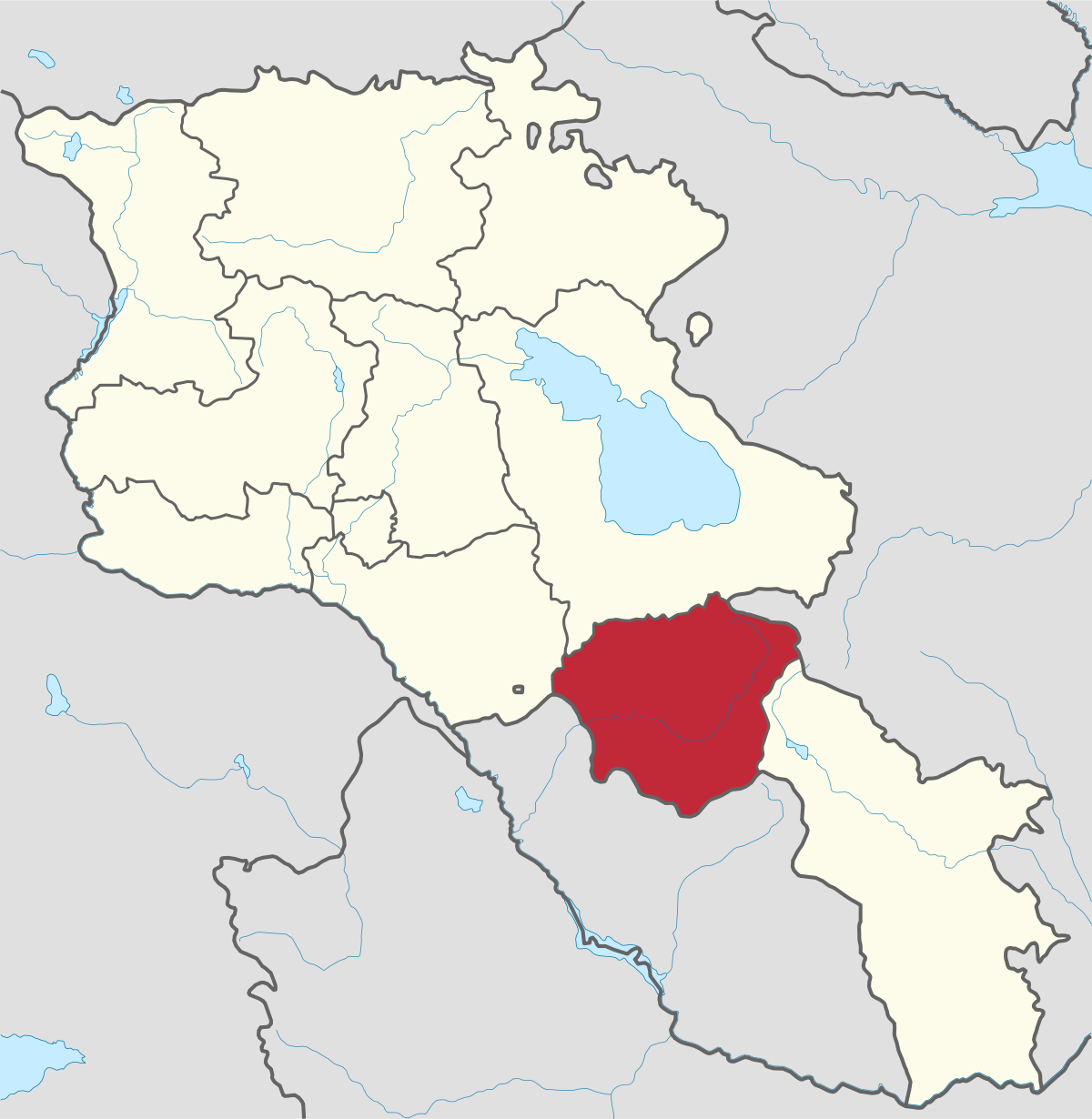
Aragatsotn Region
Aragatsotn is named after the massive mountain (4095m / 13,435 ft.) that hovers over the northern reaches of Armenia. This region is one of the...
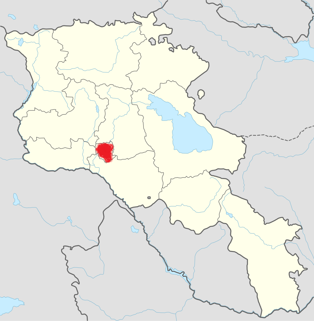
Ashtarak City
Territory: 4161,02 ha
Population: 21,475
Distance from capital/Yerevan: 20 Kilometer
Height of above sea level: 1175 m
The main branches of economy: industry, agriculture,
The province centre Ashtarak is situated on the bank of Kasakh river, in the distance of 20 km to the North-West from Yerevan. Town is the junction of Yerevan-Gyumri and Yerevan-Spitak roads.
Ashtarak town developed as a satellite town of Yerevan. It is administrative and political, economic, scientific, educational and cultural centre of the marz. The main branch of economy is food and beverage production.
Ashtarak name is concerned with the name of fertility and love goddess Ishtar. There is another version, on which near to Ashtarak heights had 4-5 millennial towers, in Armenian called ashtarak.
Tourist Attractions
The town is built on both side of the Kasakh River, with most of the sites you will want to see on the left bank (west). This is where Ashtarak’s collection of Medieval churches is located: Spitakavor (4-5th cc), Tsiranavor (5-6th cc), Karmravor (7th c) and S. Marineh (1281). The right bank also has a late medieval bath, Urartian irrigation channel and fort remains, a Medieval mill and pretty 19th c houses. The 1661 bridge is located in the gorge while a modern church built on medieval foundations is located on the top of the right bank.
Industry and Science
In this city you’ll find the Institute of Radiophysics and Electronics of the National Academy of Armenia, the Research Institute of Physics, the ,,Mashtots,, Research and Production Enterprise, ,,Kimenta-1,, research company, special engineering and special construction technology bureaus.

Aragatsotn is named after the massive mountain (4095m / 13,435 ft.) that hovers over the northern reaches of Armenia. This region is one of the...
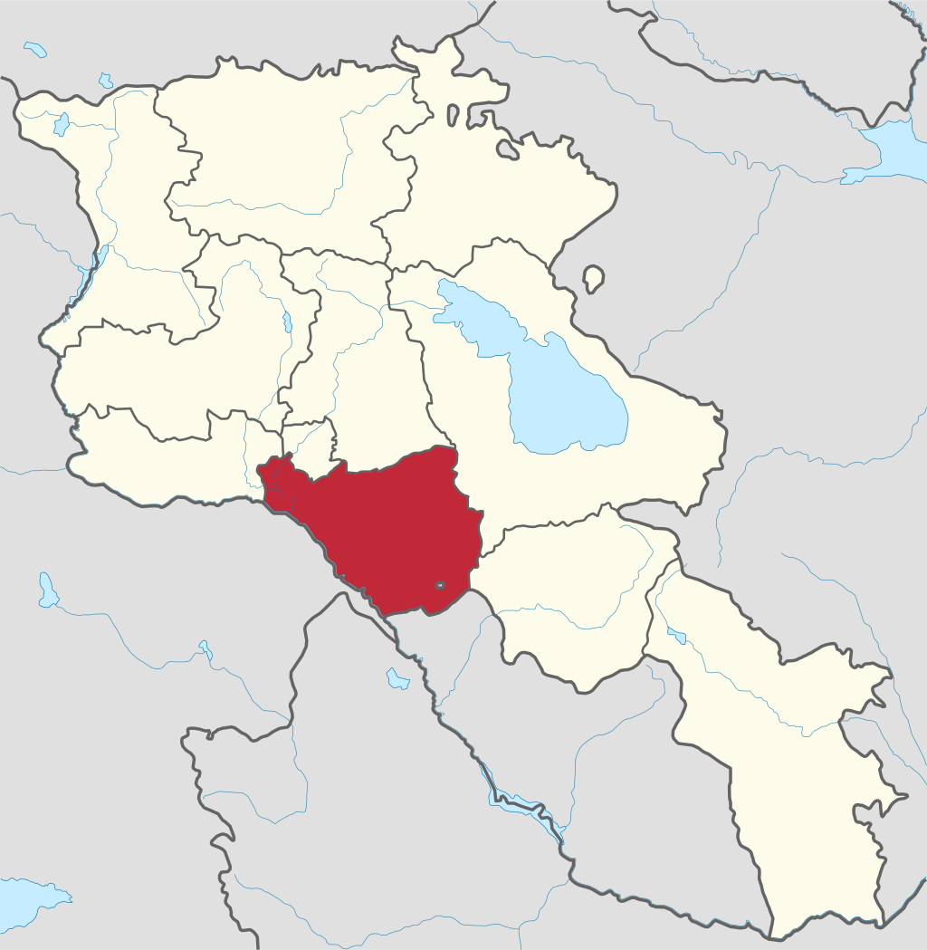
Ararat region is named after the biblical Mount Ararat which is mentioned in the Bible as a place where Noah’s ark has landed after the Great...
.png)
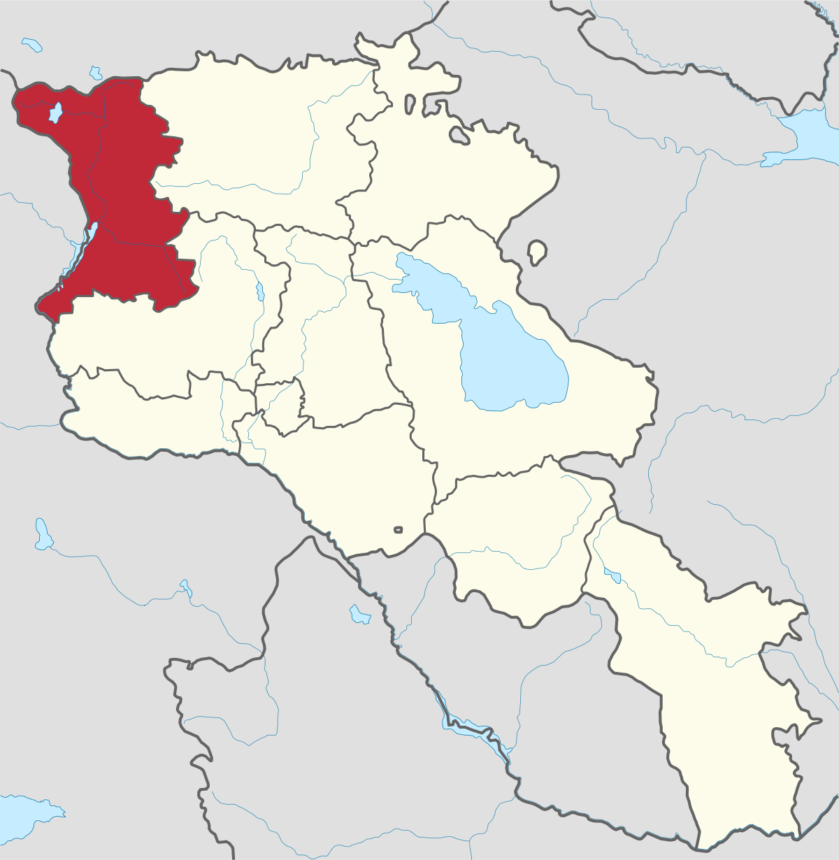
Armavir Region - Because of its Christian history the region is most famous for locals and Diaspora Armenians, who make pilgrimages to Armenia to...
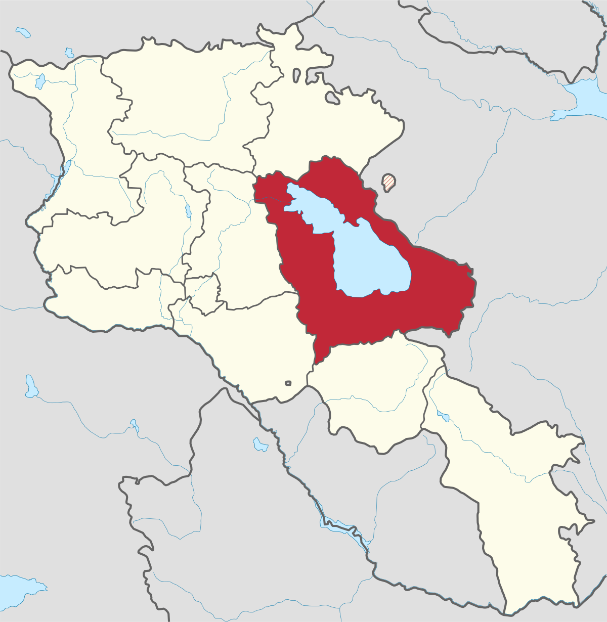
Gegharkunik ist die größte Region Armeniens, die an Aserbaidschan und die Shahumyan-Region der Republik Berg-Karabach grenzt. Ein Viertel der...
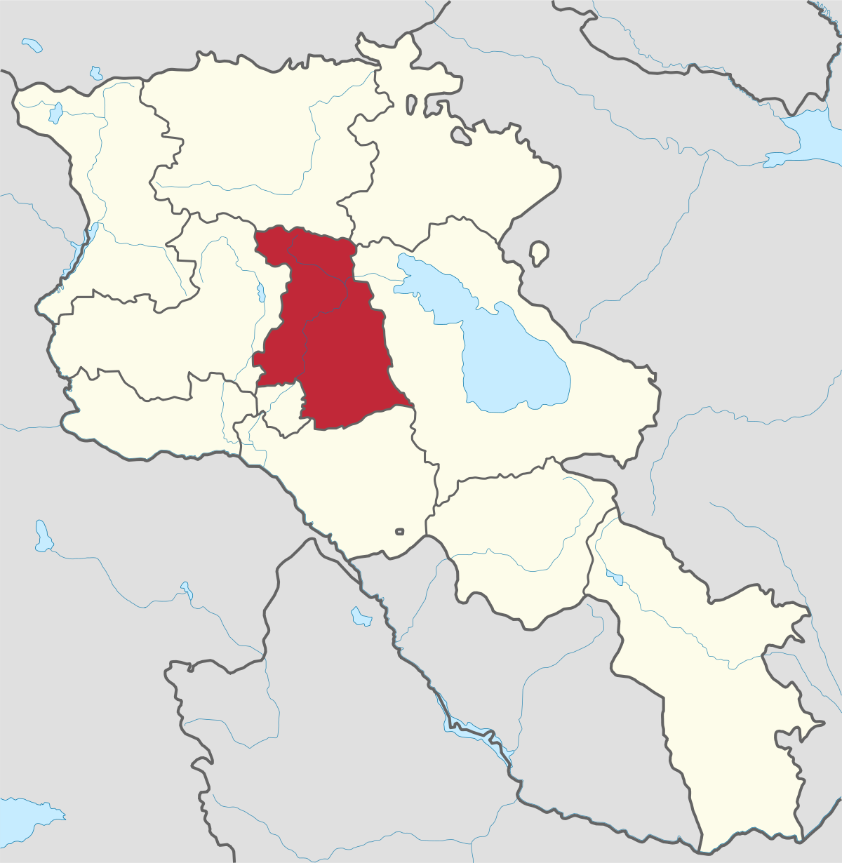
Kotayk region is located at the central part of the country and is home to many must-see sites in Armenia including the pagan Temple of Garni...
Lori region is in the northern part of Armenia, bordering on Georgia. It is considered Armenia’s greenest area, with more native forest land than...
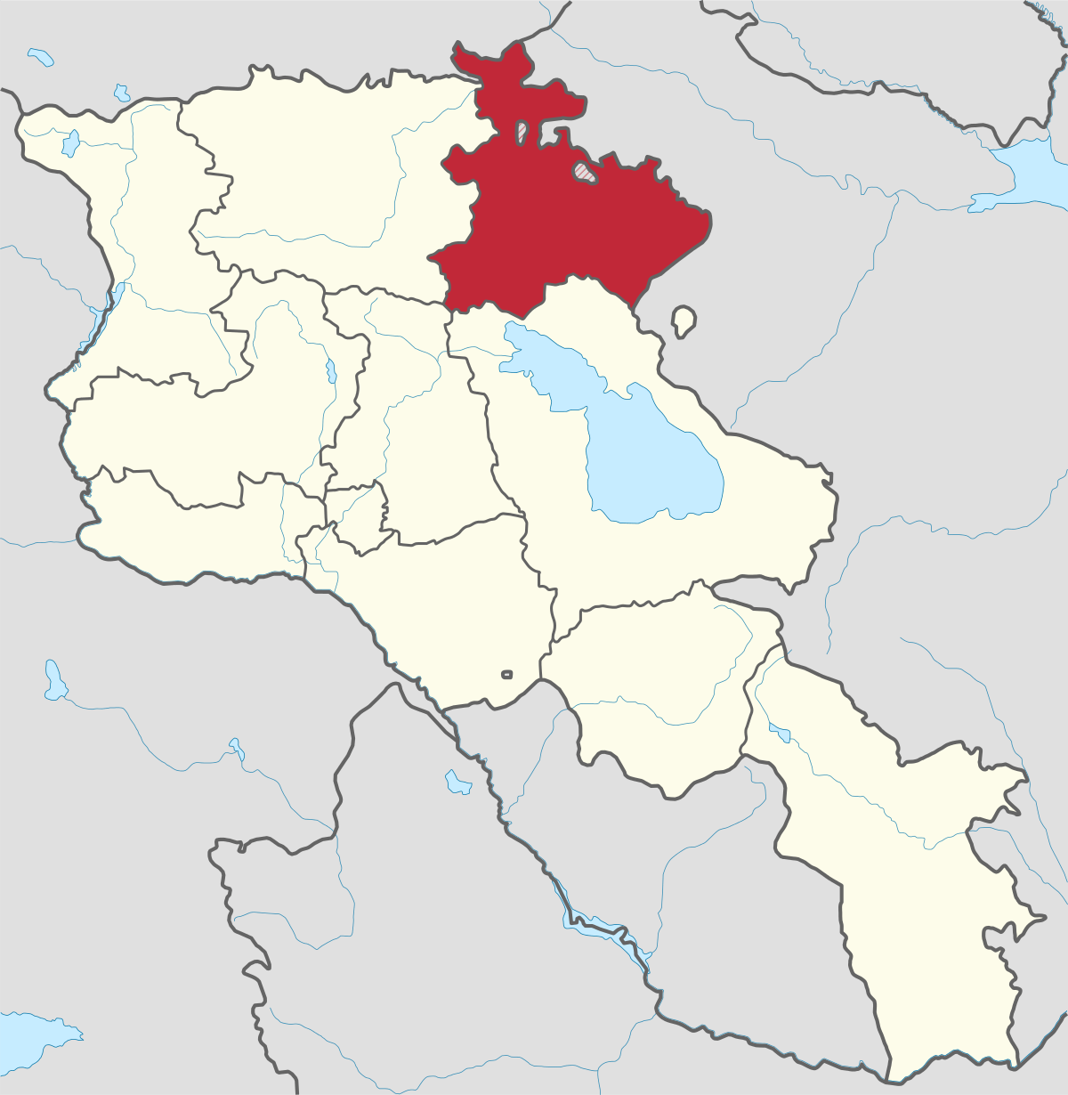
Shirak region lies in the north-west of Armenia. It borders with Georgia and Turkey. Shirak region is mainly dominated by the Ashotsk Plateau and...
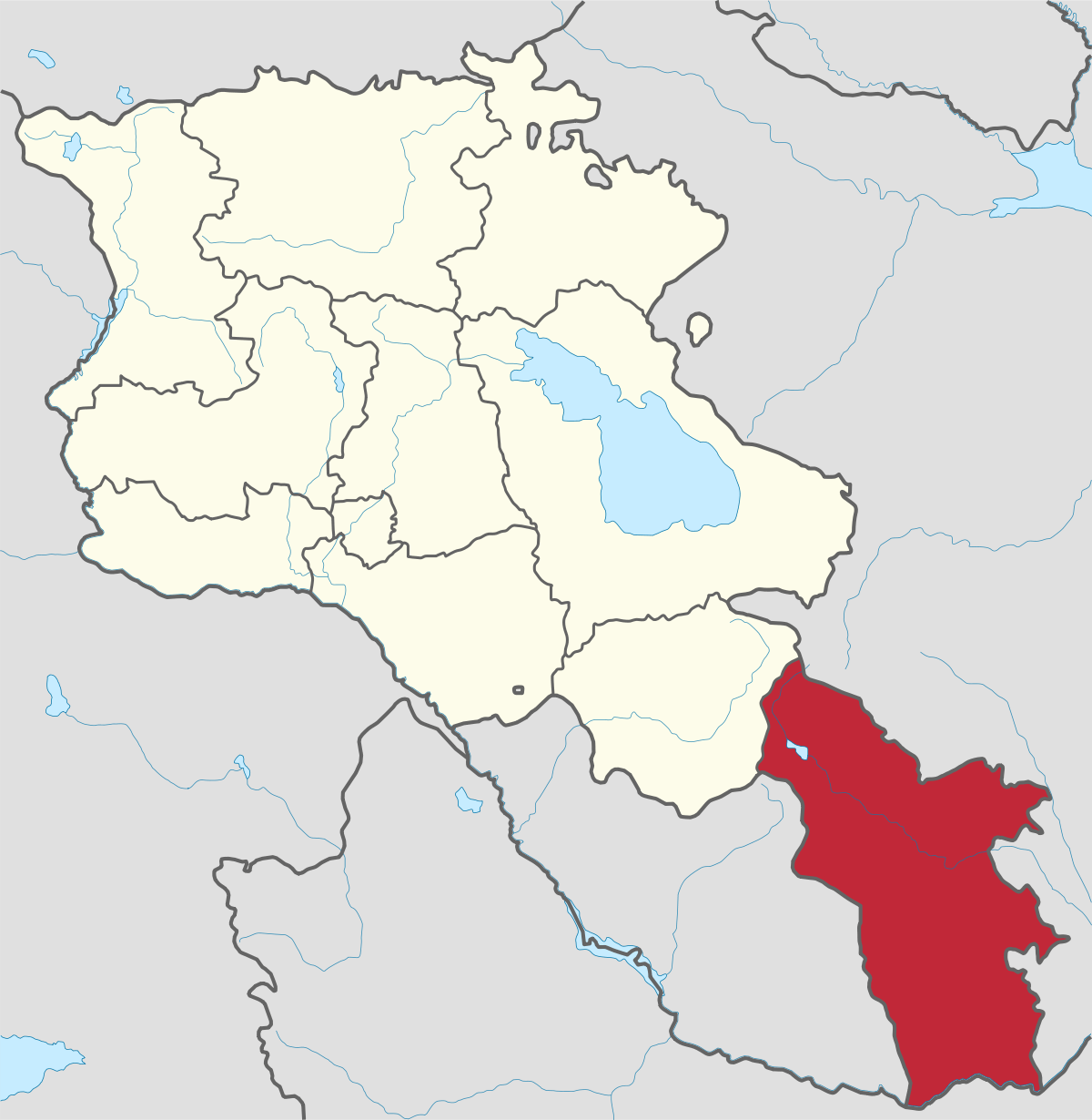
Syunik region- It is in the southern part of Armenia, bordering by Azerbaijan's Nakhchivan Autonomous Republic exclave, the de facto independent...
Tavush region lies in the Northeast of Armenia, bordering by Georgia and Azerbaijan. The territory is mainly mountainous and rocky hillsides...
Vayots Dzor region is mainly a mountainous region at the southeastern end of the country, known with Jermuk Waterfall, Areni cave, Smbataberd...
Yerevan city – 2800 years old. Yerevan is the capital of the Republic of Armenia with more than 1 million people. It is an amazing city with view...
800
149
1476
32