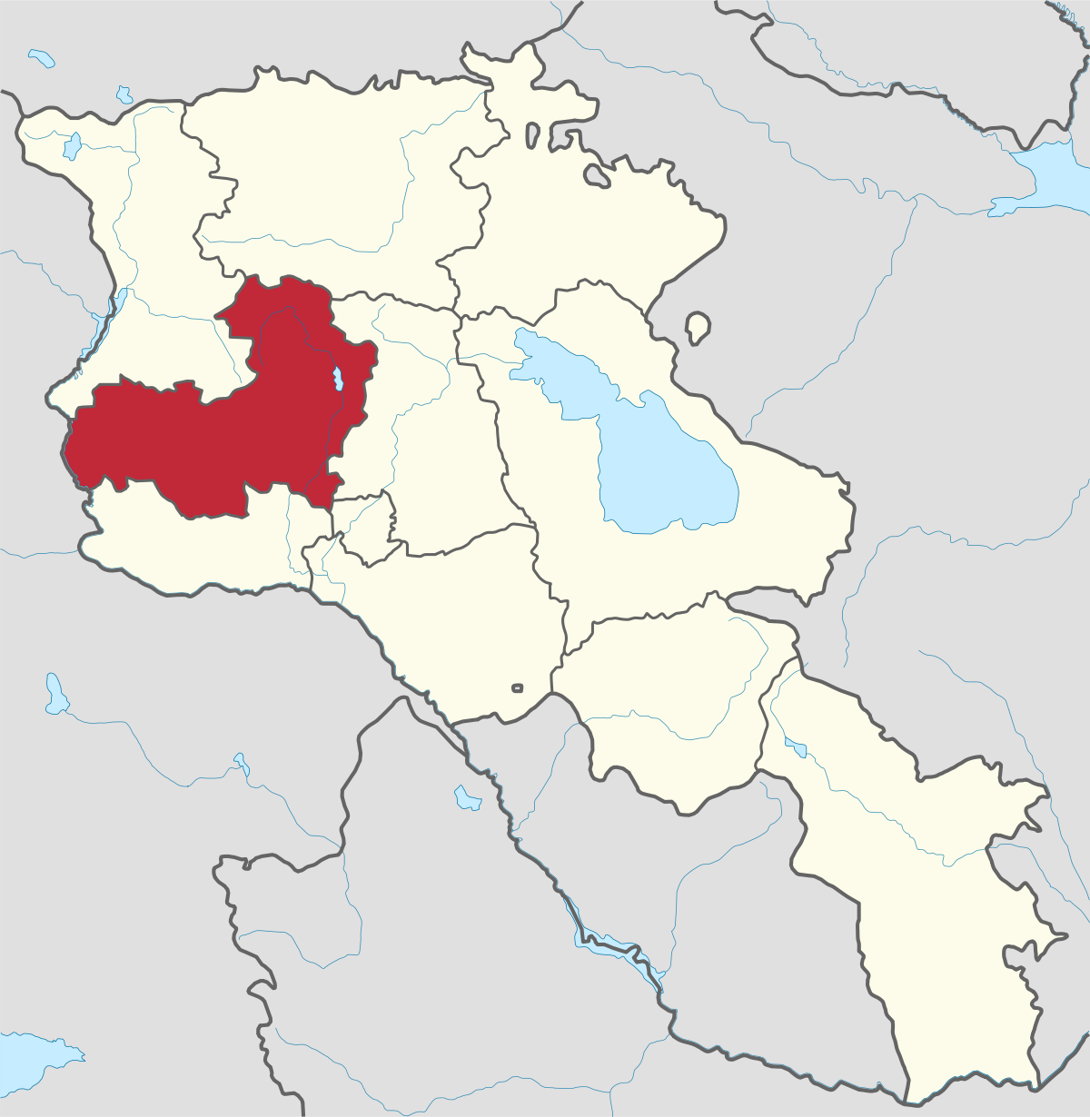
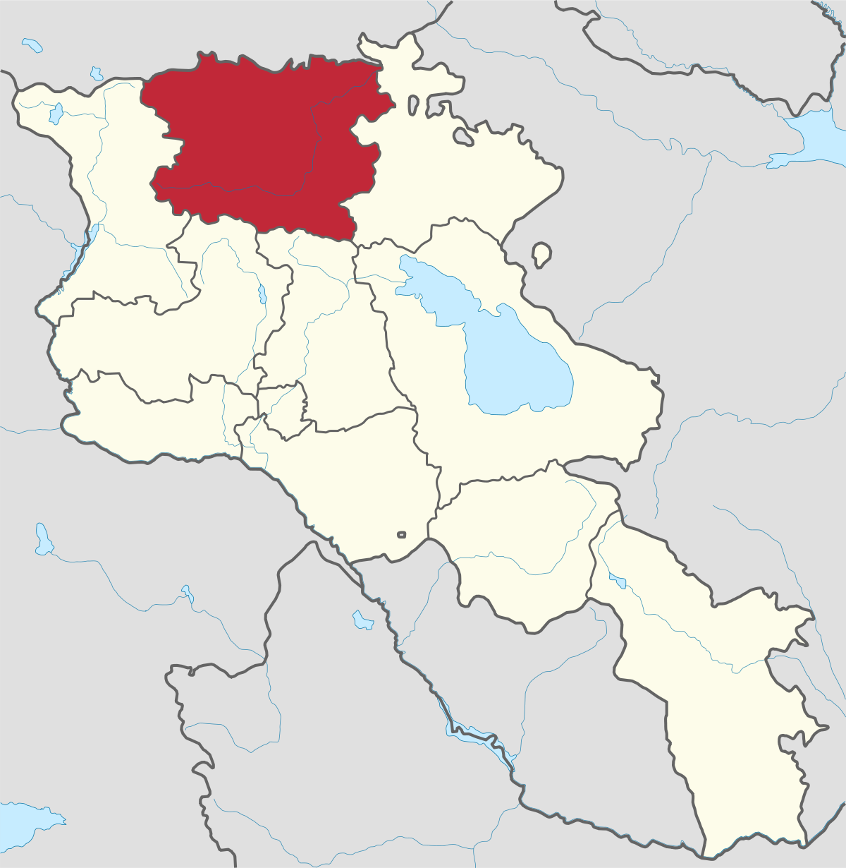
Aragatsotn Region
Aragatsotn is named after the massive mountain (4095m / 13,435 ft.) that hovers over the northern reaches of Armenia. This region is one of the...
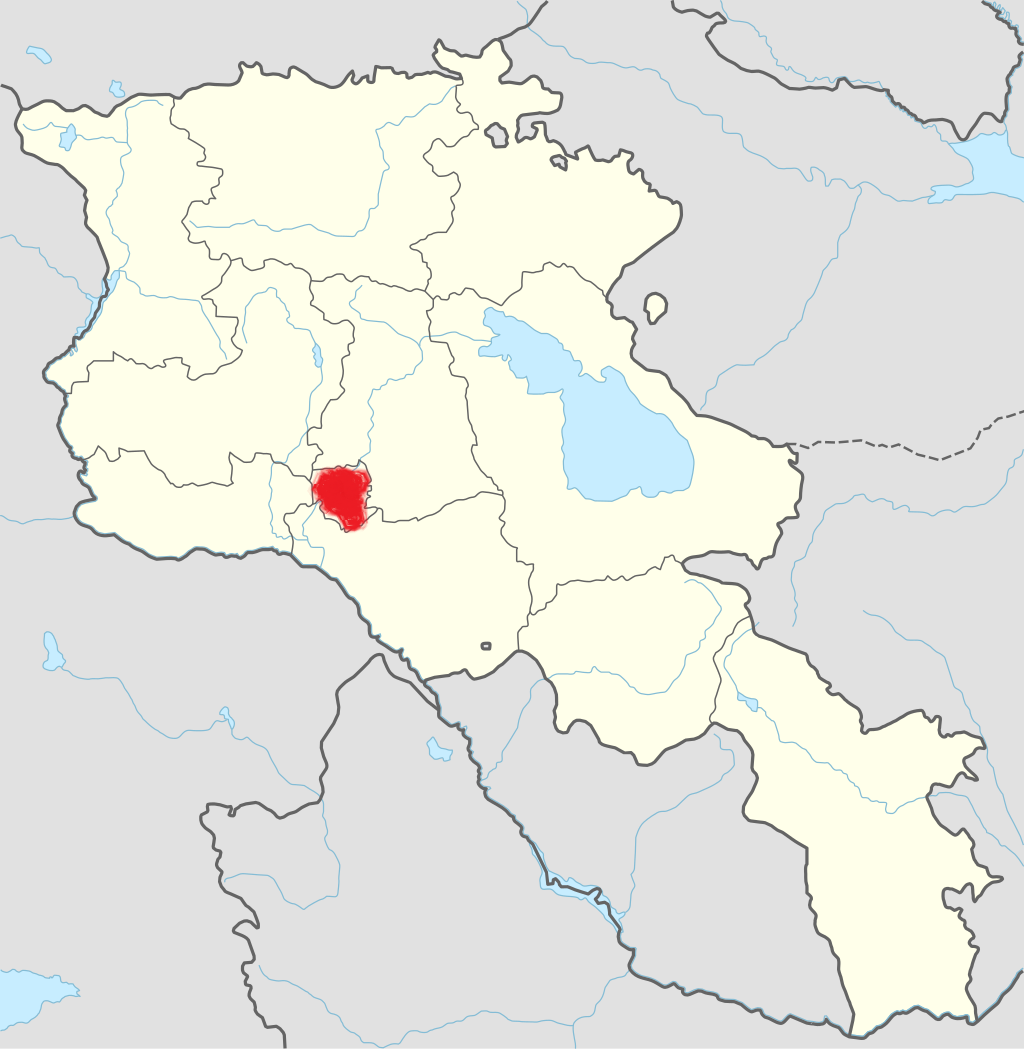
Kapan City
Territory: 45,711 km2
Population: 45,500 Persons
Distance from capital/Yerevan: 300 km
Height of above sea level: 750-1050 m
The main branch of economy: industry
Kapan is located in the southern half of Syunik, about 300 km from Yerevan on the (M2). The town straddles the ccc River and is hemmed in by the towering Zangezur Mountain Range and the foothills of Mt. Khustup, Armenia’s “Matterhorn”.
History
This city is the administrative capital of Syunik Marz and a once prosperous city that combined mining riches with light and heavy manufacturing to derive its income. With the closing of the rail link with Baku, the export lifeline for the city was severed, and the city fell on bad times.
Kapan is one of the oldest cities of Armenia, its rock shelves and canyon caves inhabited in the Stone Age. Original inhabitants entered the territory coming up the Voghchi river canyon, which connected southern Syunik with the Arax River and the Caspian Sea.
The name causes fits among visitors, as locals interchangeably call the town “Kapan” or “Ghapan”. The word “ghapan” denotes “canyon” in old Armenian, and the town has had that name from at least the 4th century BCE, when the fortress town is listed as part of the Kapan area of the Siunik District of Greater Haik (ca. 400 BCE-428). It is also listed in 5th c Armenian chronicles, as an important political and cultural center for the district.
The other name under Qajar (18th-20th cc Persian rulers of Turkish descent) rule was Madan which is Persian for Mine, a suitable description for the rich veins of copper, platinum, zinc in the area. Mining began in the Bronze Age, but accelerated in the late medieval and Persian era, expanding under French investment in the 19th c. Additionally, the area is rich with limestone and granite deposits, which are also quarried.
Economy
Kapan became one of the last Armenian districts to be sovietized, and resisted its control throughout the early Soviet period. It became capital of the district of the same name in 1930, and had an explosive growth rate under Soviet rule, especially after WWII, when the rail line connecting the town with Baku and the rest of the Soviet Union allowed the town to export raw minerals, plus to developed heavy manufacturing at large factories that lined the river.
The entire manufacturing sector collapses immediately following the end of the Soviet Union, as the rail line was cut by Azeris in response to Armenia’s support of Karabakh independence, and both sides entered an undeclared war.
Kapan became the capital of the new district of Siunik in 1995. Since then, it has struggled to regain its once-envied livelihood, when it was known as one of the richest communities in Armenia.
Also today the main branches of economy is industry, particularly the mining industry. The manufacturing industry (production of food, clothing, non-metallic construction materials, aluminum and metal products, wood and wood products, furniture and equipment) and electricity production have also the significant share.
There are food industry, wholesale trade, public catering and household service and many other commercial organizations and individual companies.

Aragatsotn is named after the massive mountain (4095m / 13,435 ft.) that hovers over the northern reaches of Armenia. This region is one of the...
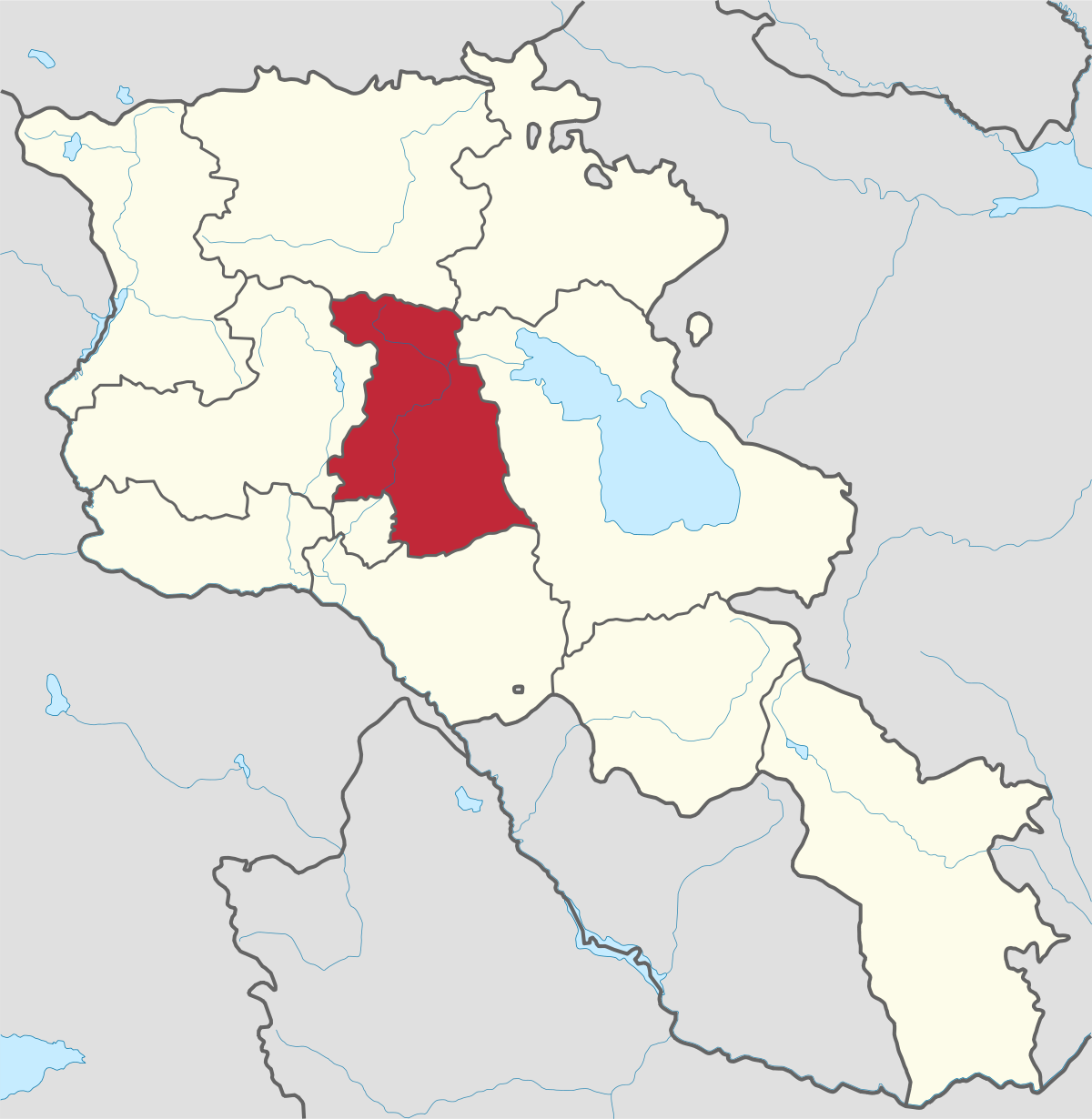
Ararat region is named after the biblical Mount Ararat which is mentioned in the Bible as a place where Noah’s ark has landed after the Great...
.png)
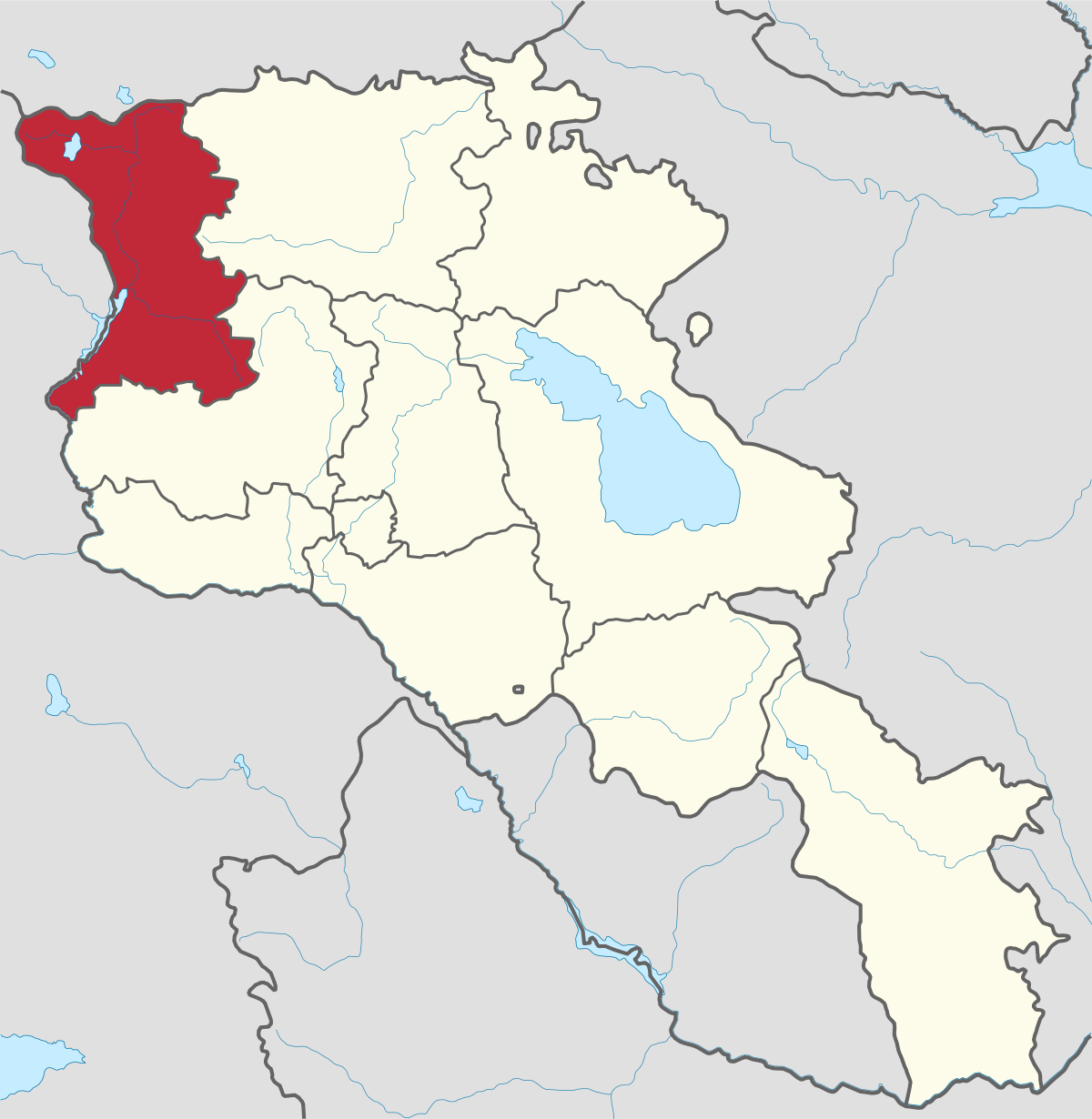
Armavir Region - Because of its Christian history the region is most famous for locals and Diaspora Armenians, who make pilgrimages to Armenia to...
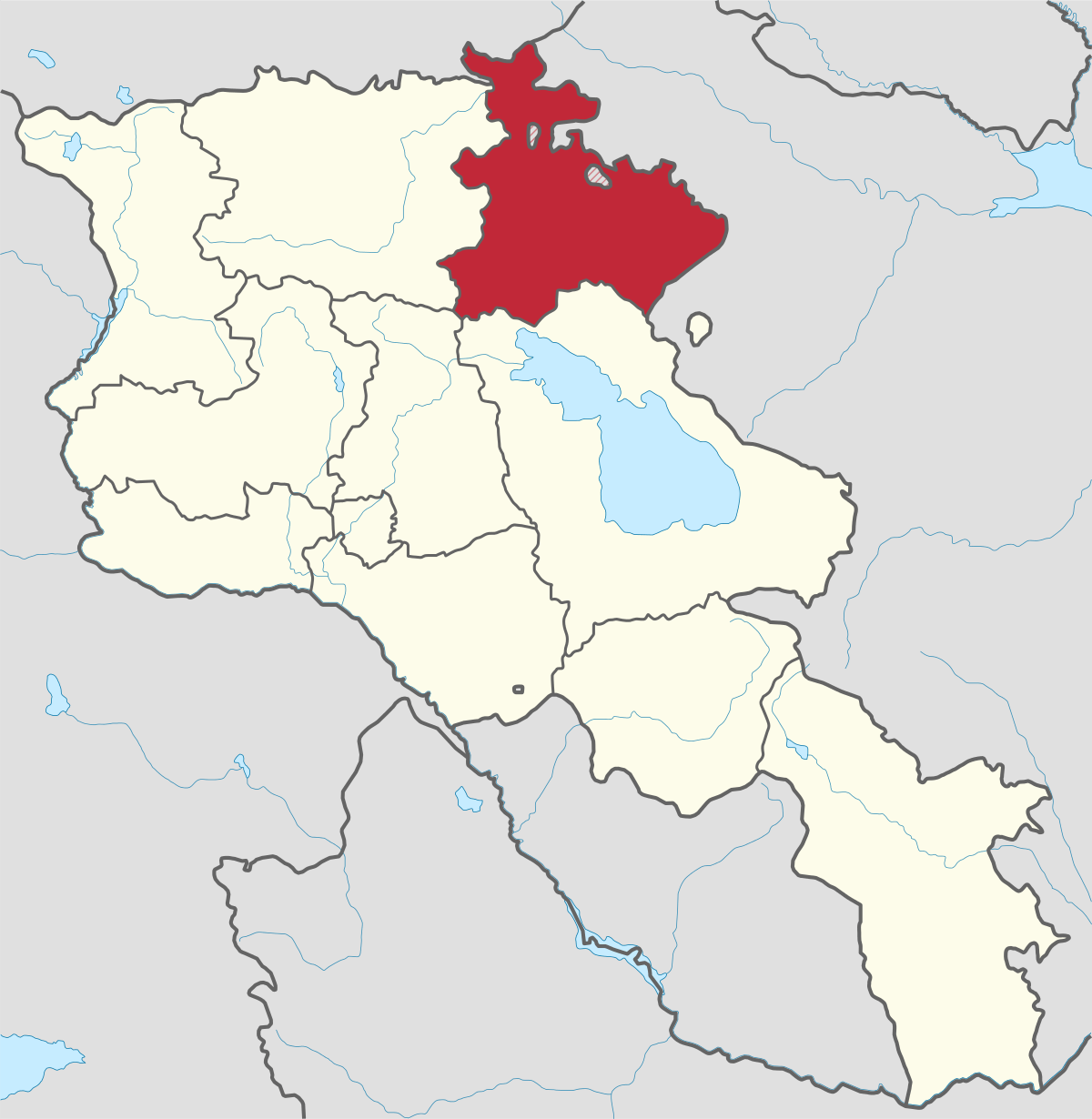
Gegharkunik ist die größte Region Armeniens, die an Aserbaidschan und die Shahumyan-Region der Republik Berg-Karabach grenzt. Ein Viertel der...
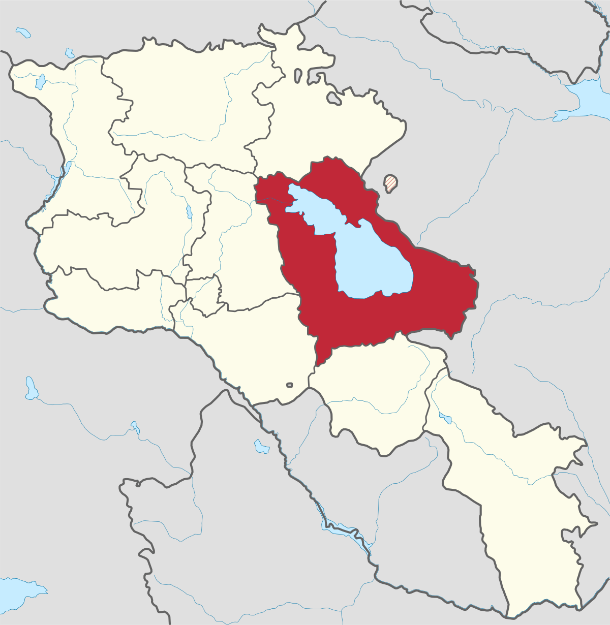
Kotayk region is located at the central part of the country and is home to many must-see sites in Armenia including the pagan Temple of Garni...
Lori region is in the northern part of Armenia, bordering on Georgia. It is considered Armenia’s greenest area, with more native forest land than...
Shirak region lies in the north-west of Armenia. It borders with Georgia and Turkey. Shirak region is mainly dominated by the Ashotsk Plateau and...
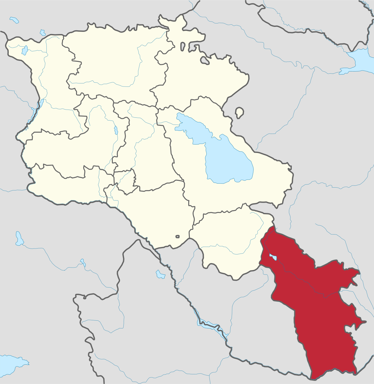
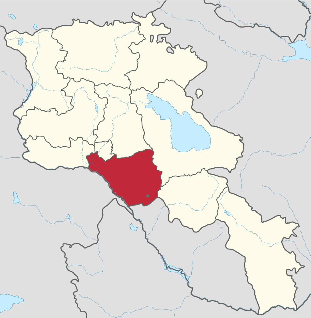
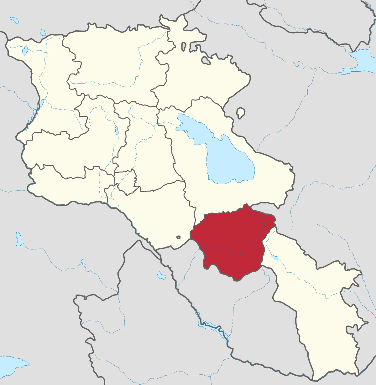
Syunik region- It is in the southern part of Armenia, bordering by Azerbaijan's Nakhchivan Autonomous Republic exclave, the de facto independent...
Tavush region lies in the Northeast of Armenia, bordering by Georgia and Azerbaijan. The territory is mainly mountainous and rocky hillsides...
Vayots Dzor region is mainly a mountainous region at the southeastern end of the country, known with Jermuk Waterfall, Areni cave, Smbataberd...
Yerevan city – 2800 years old. Yerevan is the capital of the Republic of Armenia with more than 1 million people. It is an amazing city with view...
800
149
1476
32