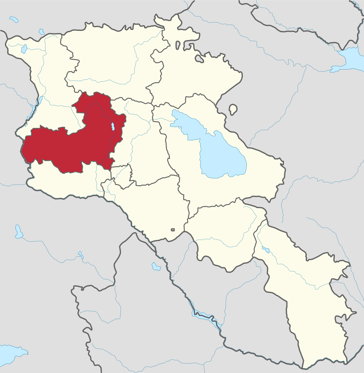
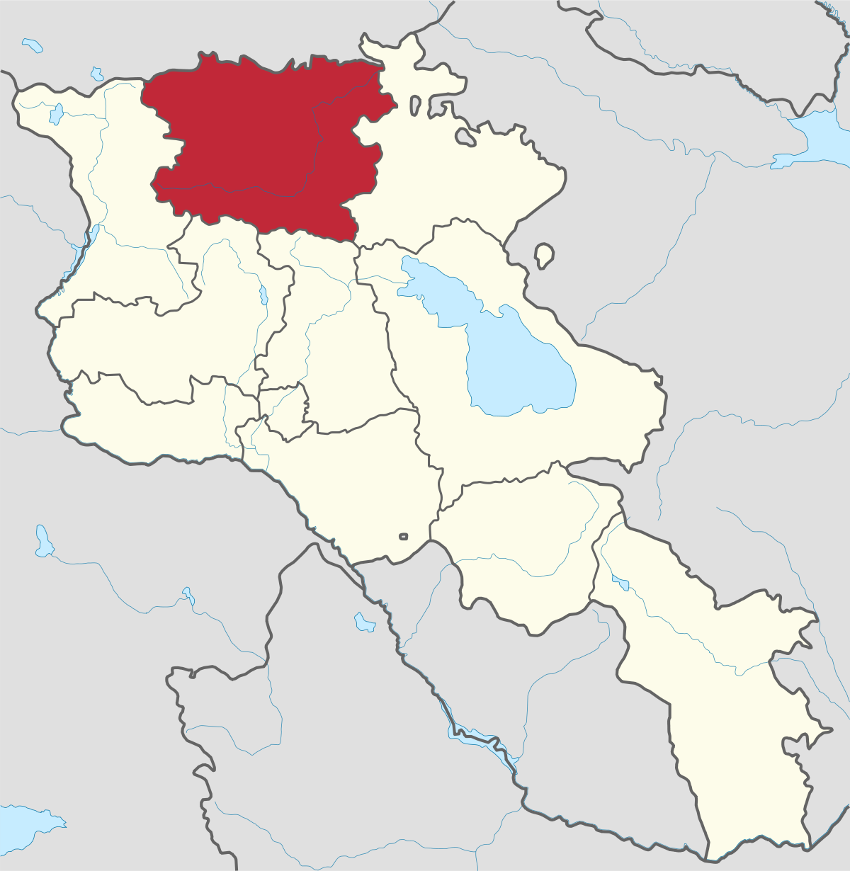
Aragatsotn Region
Aragatsotn is named after the massive mountain (4095m / 13,435 ft.) that hovers over the northern reaches of Armenia. This region is one of the...
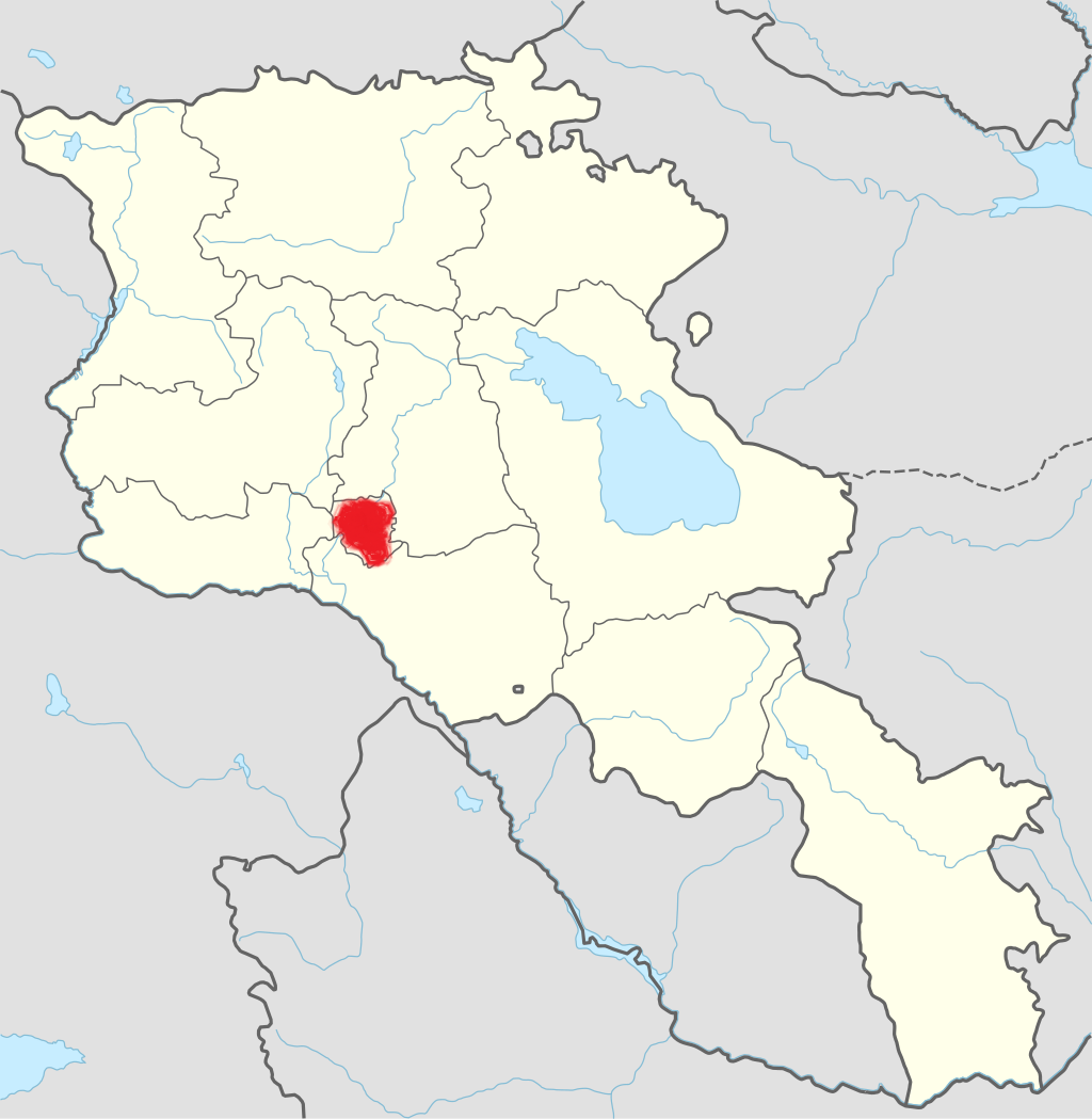
Goris City
Territory: 4,506 km2
Population: 20’000
Distance from capital/Yerevan: 245 km
Height of above sea level: 1370m
The main branch of economy: industry
Goris received a status of a city in 1885. It is located 1250-1520 meters above sea level in the region Syunik. The rocks, deep canyons and caves makes the city especially attractive.
The M-2 Motorway that connects the capital Yerevan with the Nagorno-Karabakh Republic passes through Goris.
History
Goris has been called differently in various periods: Geryusi, Gerusi, Goraik, Gores, Goris, Old Kyores, Kyuris, Coru, Kuris, Zangizur, Zankyazur, Kyuryus.
The name of the city means “rocky place”, originating from an Indo-European language: “gor” means “rock” and “is, es” means “to be.”
Nowadays it is a prominent cultural center with its cultural palace, a public library and a dram theatre.
Economy
The main branch of city is industry, namely production of food and beverages, textile and sewing produce, machines and equipment, electric energy production and distribution comprised considerable. The home-made fruit vodkas are especially good and famous in Goris. Goris is home to the annual Mulberry festival taking place in the summer.
Goris is home to the Vorotan Hydropower Plant which one of the main providers of electrical power in Armenia. There are also other large industrial firms, such as "Vosmar" company for asphalt concrete and crushed stone, "Goris Gamma" for electronic devices and the "Goris Group" for bottled spring water. Old Kores with cave-rocks is one of the most attractive sites in Goris.

Aragatsotn is named after the massive mountain (4095m / 13,435 ft.) that hovers over the northern reaches of Armenia. This region is one of the...
Ararat region is named after the biblical Mount Ararat which is mentioned in the Bible as a place where Noah’s ark has landed after the Great...
.png)
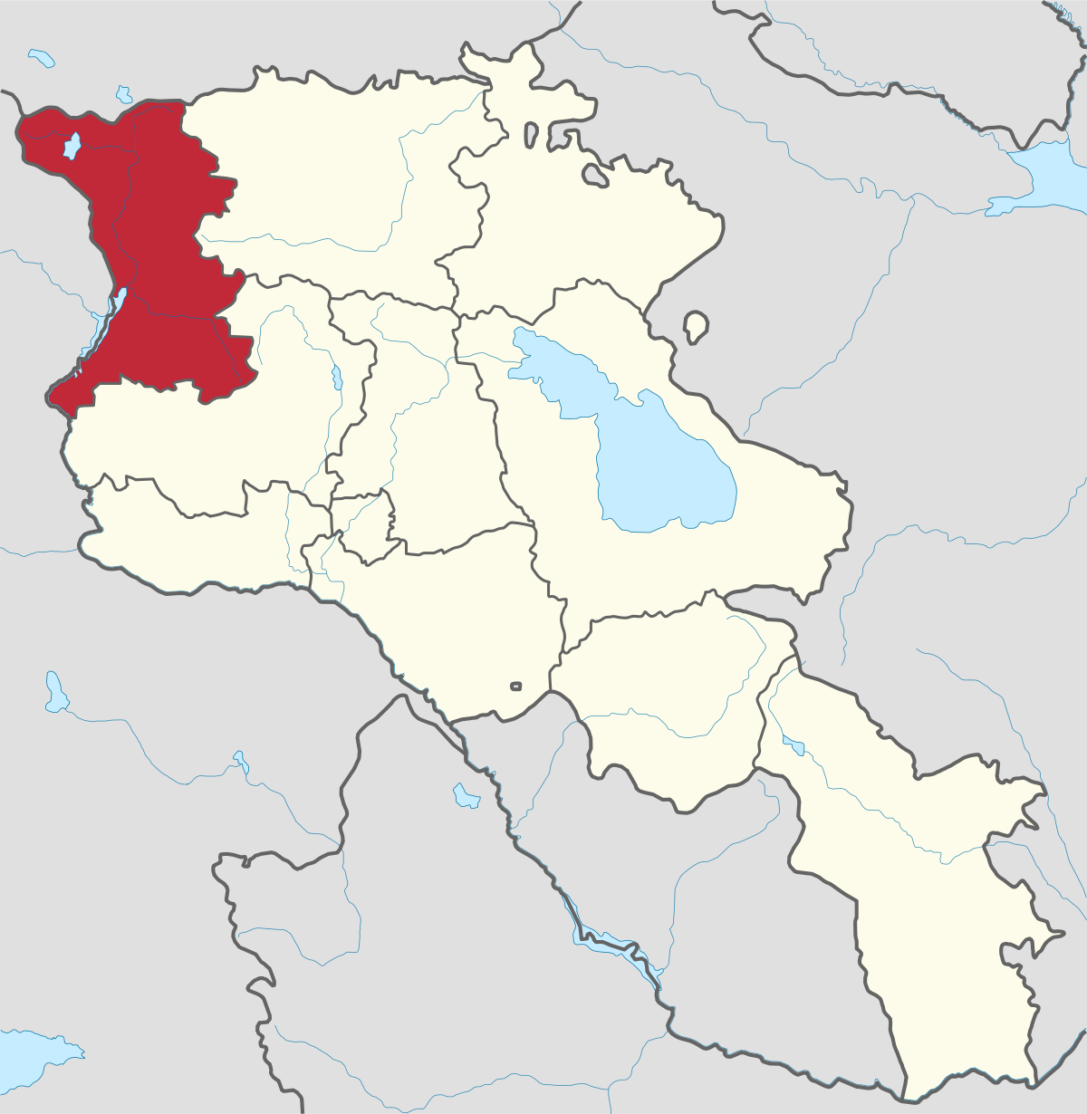
Armavir Region - Because of its Christian history the region is most famous for locals and Diaspora Armenians, who make pilgrimages to Armenia to...
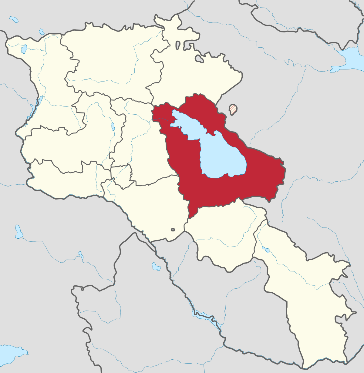
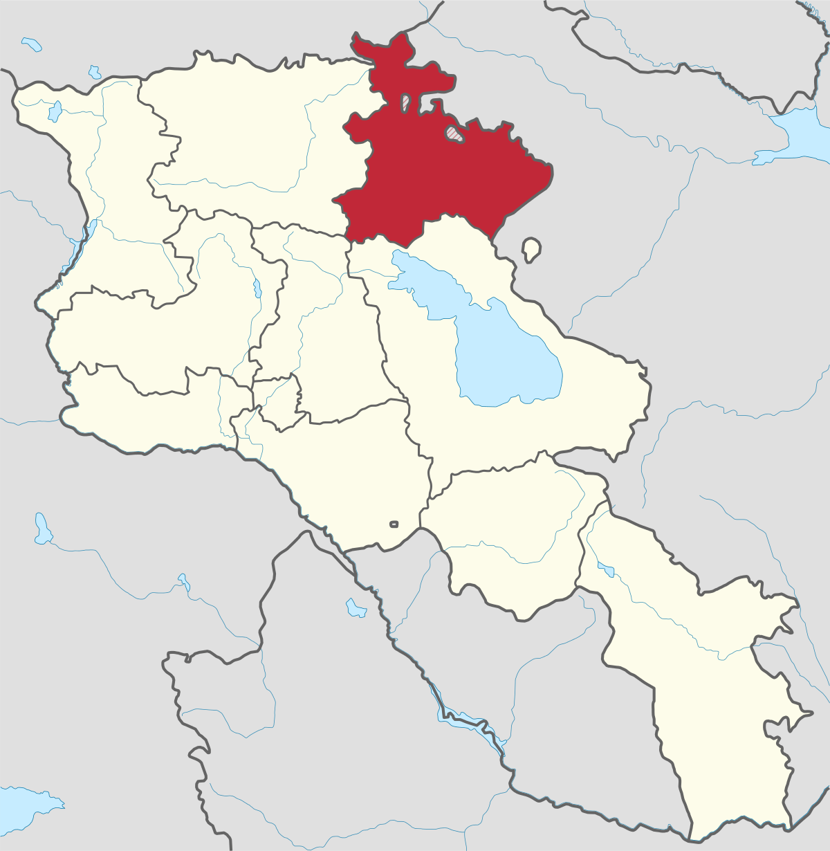
Gegharkunik ist die größte Region Armeniens, die an Aserbaidschan und die Shahumyan-Region der Republik Berg-Karabach grenzt. Ein Viertel der...
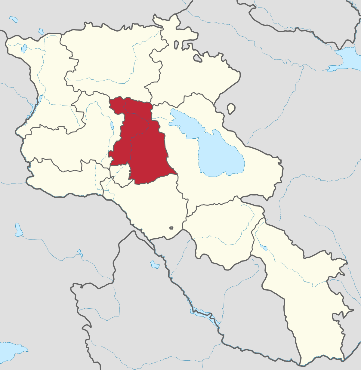
Kotayk region is located at the central part of the country and is home to many must-see sites in Armenia including the pagan Temple of Garni...
Lori region is in the northern part of Armenia, bordering on Georgia. It is considered Armenia’s greenest area, with more native forest land than...
Shirak region lies in the north-west of Armenia. It borders with Georgia and Turkey. Shirak region is mainly dominated by the Ashotsk Plateau and...
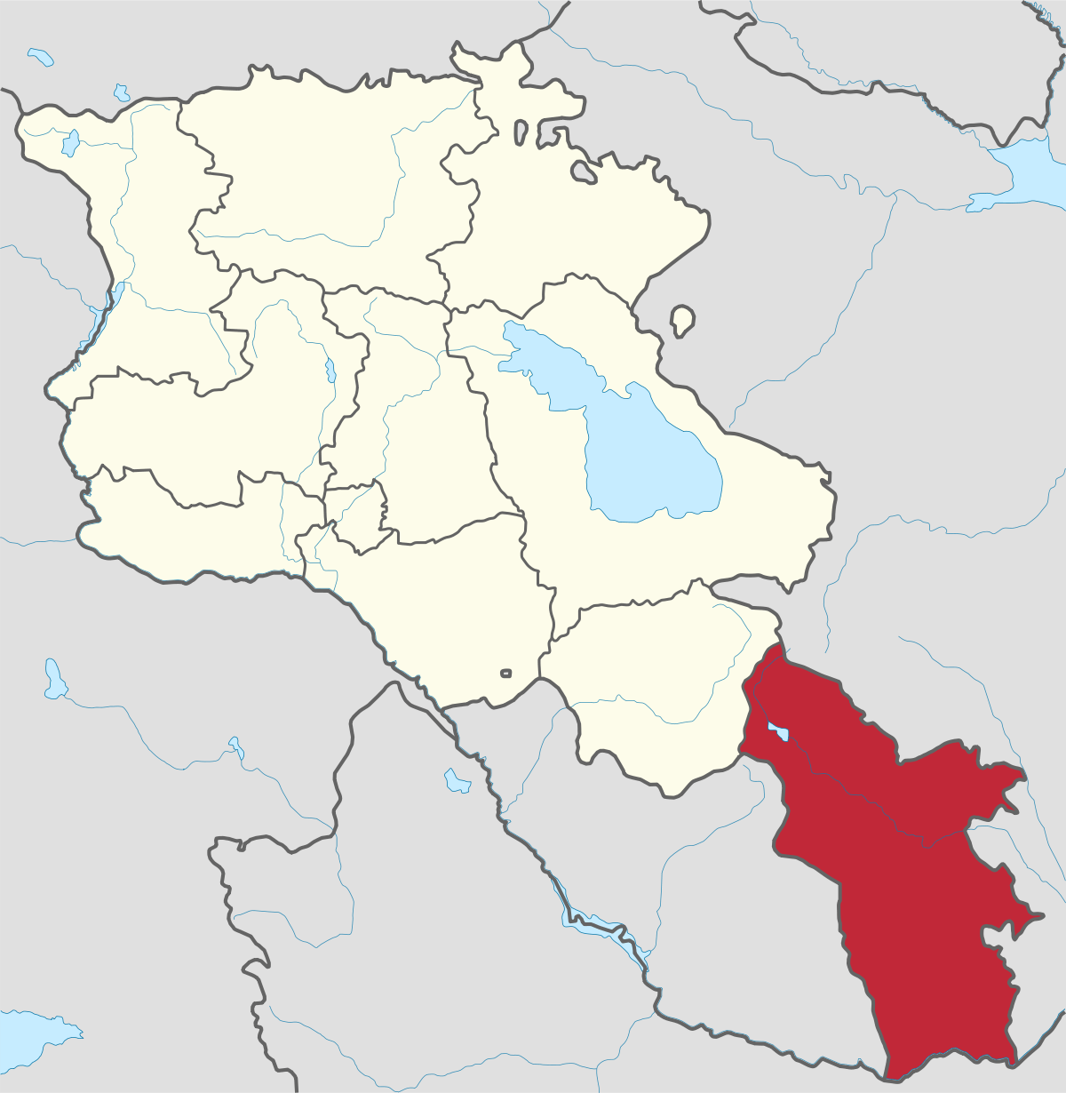
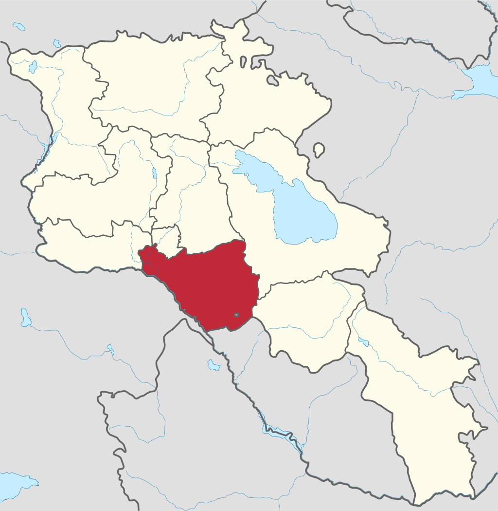
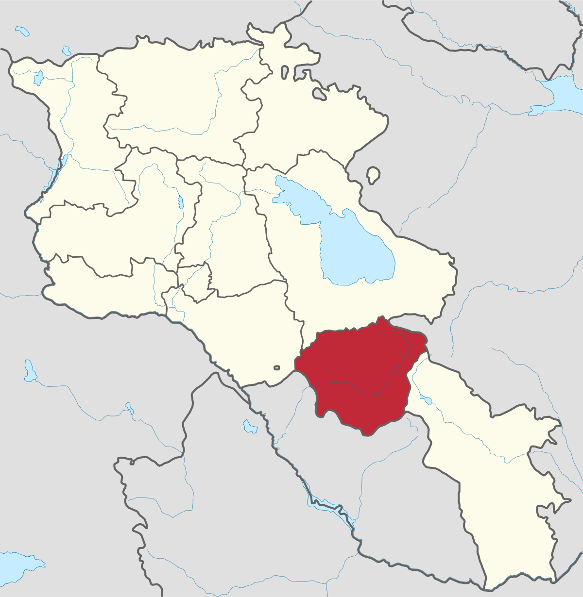
Syunik region- It is in the southern part of Armenia, bordering by Azerbaijan's Nakhchivan Autonomous Republic exclave, the de facto independent...
Tavush region lies in the Northeast of Armenia, bordering by Georgia and Azerbaijan. The territory is mainly mountainous and rocky hillsides...
Vayots Dzor region is mainly a mountainous region at the southeastern end of the country, known with Jermuk Waterfall, Areni cave, Smbataberd...
Yerevan city – 2800 years old. Yerevan is the capital of the Republic of Armenia with more than 1 million people. It is an amazing city with view...
800
149
1476
32